
Kelp Assessments and Programs

Kelp Assessments
Four main methods are used to measure and assess kelp:
Satellite

Aerial Photography
Small Vessel
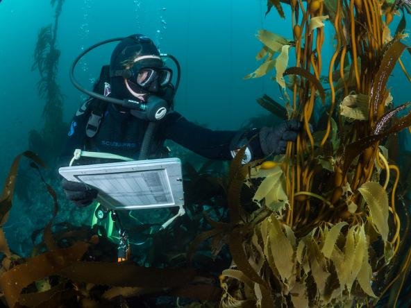
Scuba Divers
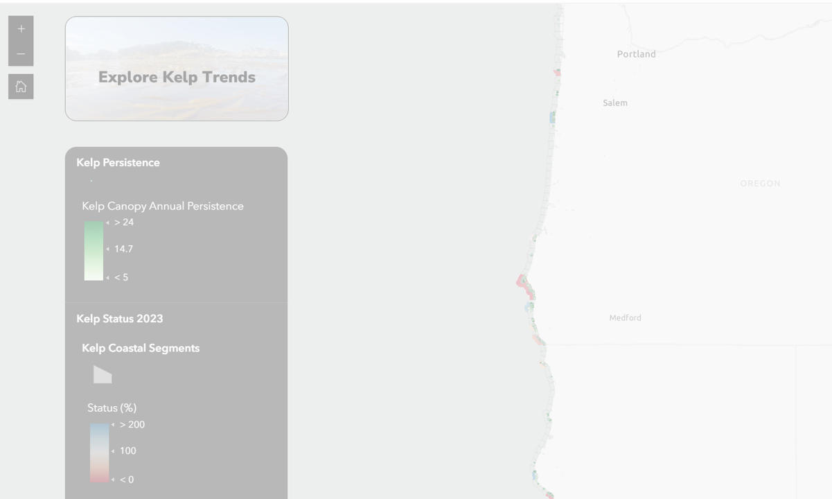
The Kelp Forest Monitoring Alliance of Washington State
Program and Timeline: The Washington Department of Natural Resources has conducted annual aerial surveys of the extent of floating kelp canopy since 1989. In 2013, Washington began assessing kelp via kayak surveys. In 2021, Washington began collecting kelp images via drones, and in 2022, it began collecting 4-band aerial imagery to measure extent and canopy area of the floating kelp bed.
Geography: Washington Coast and Puget Sound
Alignment with the West Coast Ocean Health Dashboard's Kelp Indicator: The Kelp Forest Monitoring Alliance of Washington State makes an assessment of kelp for Puget Sound Vital Signs (Vital Signs | Floating kelp bed area (wa.gov), which relies on metrics of kelp canopy coverage. This is in alignment with the Ocean Health Dashboard’s Kelp Indicator that also uses kelp canopy coverage. Their assessment includes both the outer coast and inner Salish Sea while the Ocean Health Dashboard’s Kelp Indicator only assesses Washington’s outer coast. Where geographies overlap, there is agreement. Both kelp indicators report no trends in kelp along the western strait and outer coast of Washington.
Data access: Washington State Department of Natural Resources GIS Open Data

Channel Islands National Marine Sanctuary

Program and Timeline: Since 2005, the Channel Islands National Park has monitored Giant kelp (Macrocystis pyrifera) annually via their national park subtidal scuba surveys. Channel Islands National Marine Sanctuary has also used Landsat data to assess giant-kelp canopy biomass from 1984 to 2009 (10.3354/meps09141).
Geography: The Channel Islands National Marine Sanctuary, California
Alignment with the West Coast Ocean Health Dashboard's Kelp Indicator: This section is in progress. Please pardon our dust.
Data access: No direct data access.
KelpWatch.org
Program and Timeline: KelpWatch is a mapping platform for the SBC LTER: Time series of kelp biomass in the canopy from Landsat. The mapping platform has canopy data back to 1984 and is updated quarterly.
Geography: West Coast wide
Alignment with the West Coast Ocean Health Dashboard's Kelp Indicator: The KelpWatch mapping platform relies on the same data source as the Kelp Indicator. An assessment of kelp from KelpWatch is forthcoming. When that assessment is made, alignment with the Ocean Health Dashboard’s Kelp Indicator will be determined.
Data access: KelpWatch provides processed kelp data products quarterly, going back to 1984, through its interactive mapping tool. Their recent kelp assessments are available here.

Oregon Department of Fish and Wildlife, Marine Habitat Program
Program and Timeline: State-wide kelp biomass estimate assessment was completed in 2011 using a combination of aerial photography and commercial fishing vessels.
Geography: Oregon
Alignment with the West Coast Ocean Health Dashboard's Kelp Indicator: Data from Oregon Department of Fish and Wildlife have been used during Kelp Indicator development to conduct inter-comparisons among data collection types (manuscript in prep).
Data access: Oregon Department of Fish and Wildlife, Marine Habitat Program Kelp Canopy 2011 Report
Oregon Department of Fish and Wildlife's kelp biomass surveys of the mid-1990's
Oregon Kelp Alliance: Oregon Kelp Forest Survey
Program and Timeline: Oregon Kelp Alliance's surveys began in September 2022 and are projected to be completed in August 2024.
Geography: Oregon
Alignment with the West Coast Ocean Health Dashboard's Kelp Indicator: The Oregon Kelp Alliance plans to report on the status of Oregon’s kelp resources. When that assessment is made, alignment with the Ocean Health Dashboard’s Kelp Indicator will be determined.
Data access: No data yet available.

Southern California Bight Regional Aerial Kelp Surveys
Program and Timeline: Quarterly aerial surveys to assess kelp surface canopy extent were started in 1983 in San Deigo and Orange Counties and 2003 in Los Angeles and Ventura Countries.
Geography: Southern California, California
Alignment with the West Coast Ocean Health Dashboard's Kelp Indicator: This section is in progress. Please pardon our dust.
Data access: No direct data access.

San Diego Coastal Kelp Forest Ecosystem Monitoring
Program and Timeline: Scripps Institution of Oceanography (SIO) began collecting baseline data at these sites in the 1970s, and surveys are conducted monthly to quarterly.
Geography: San Diego County, California
Alignment with the West Coast Ocean Health Dashboard's Kelp Indicator: Data from SIO surveys have been used during Kelp Indicator development to conduct inter-comparisons among data collection types (manuscript in prep). The SIO program publishes Biennial Reports. The most current reporting period of 2020-2021 found a stalled recovery from the marine heat wave that began in 2014 for kelp forests off San Diego. This is in alignment with the Ocean Health Dashboard’s Kelp Indicator, where kelp canopy cover in this region continues to be below historical expectation over this recent time period.
Data access: No direct data access.
Kelp Program Catalog
There are many excellent kelp monitoring programs that operate at different spatial scales and use methods different from those of the West Coast Ocean Health Dashboard Kelp Indicator. Learn more below!


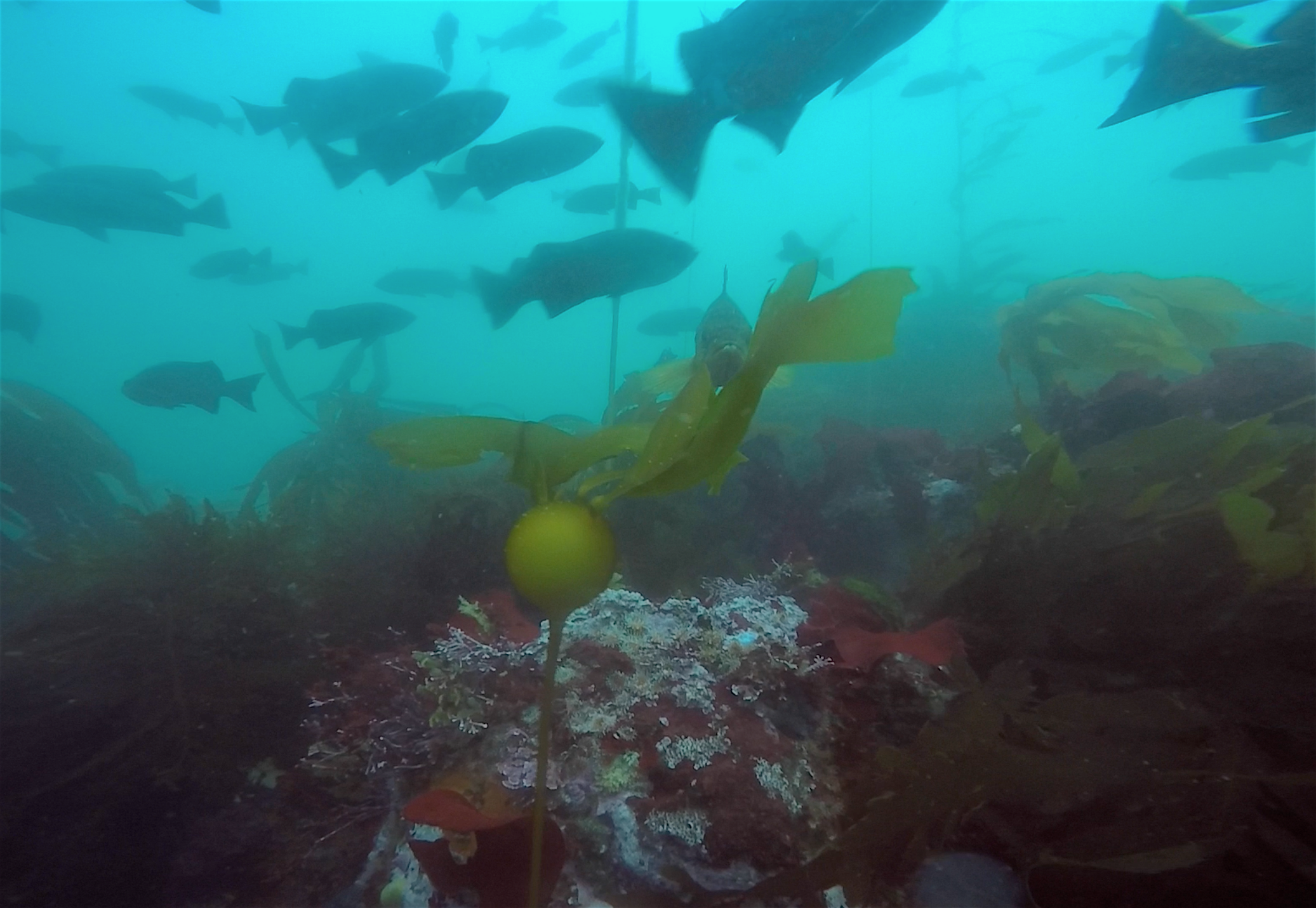
Photo Credit: kelp indicator export group members, including Oregon Kelp Alliance (ORKA), Tristin Anoush McHugh (The Nature Conservancy), and Pike Spector (California Ocean Protection Council).